
A clear picture of the big picture
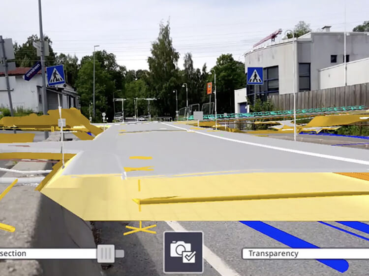
With the visualization tools to overlay design data into real-world settings at true-to-life scale in real time, you can quickly create and communicate a laser-accurate picture of how your plans will come to life. From new intersection designs to road realignments, new bridges and tunnels, SiteVision makes it easy to communicate with all stakeholders.

Buy-in, every step of the way
From the preliminary design stage to the public consultation stage, securing buy-in and support to facilitate a project is always a challenge—until now. SiteVision’s information visualization capabilities make it easy to demonstrate your proposed designs—and preferred alternatives—at every phase of a project.
Features that work for you
Data Support
Visualize all of your planning models—from concepts in SketchUp and feasibility study models in Trimble Quantm to detailed interchange designs from Autodesk® AutoCAD®—in formats you use: SKP, KML, SHP, DWG, VCL and IFC. SiteVision is ready to help communicate your route at any stage of the project. Directly connect to existing GIS databases using the WFS interface.
Model Positioning
Georeferenced models are automatically positioned, or you can accurately position your model on site using measurements, relative to property lines or other site control points. At the pre-feasibility stage, manually drag, drop and orient your model on site.
Visualization Tools
View fully attributed models, toggle between 2D and 3D views and show proposed changes relative to property lines and other constraints in a real-world view to create a realistic sense of visual impact on stakeholders and the environment
Reporting
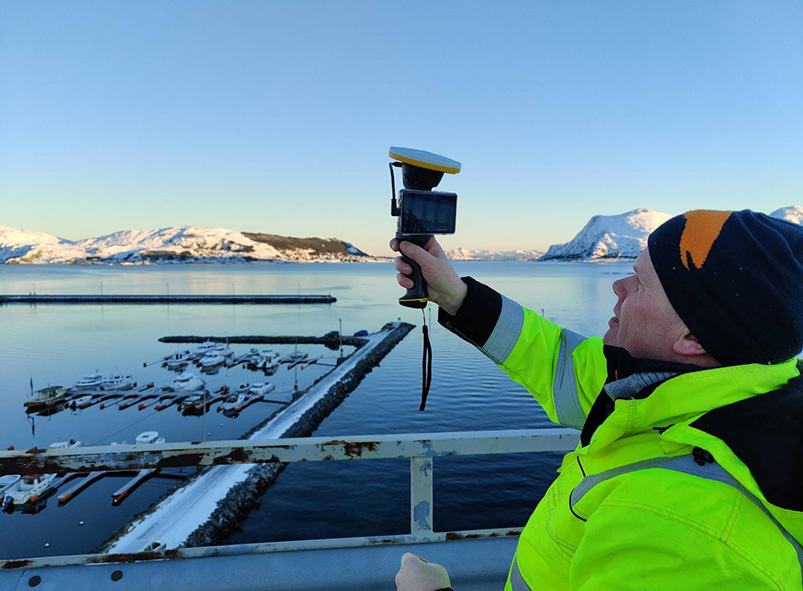
Take augmented reality photos, measurements and notes with the affected parties on-site, and share them for further consideration through Trimble Connect.
See what our customers are saying with #TrimbleSiteVision

SiteVision integrates with all your existing tools
SiteVision integrates with data from your City GIS and your design software, so you can leverage your investment in GIS for visualization and stakeholder engagement.
See what you can do with Trimble SiteVision

Trimble SiteVision
- Works with Trimble Quantm, SketchUp and your GIS data
- High accuracy position and orientation
- Electronic Distance Measurements*
- Trimble Connect Integration
- Supports iOS or Android AR-capable smartphones and tablets
*Applies only to iOS devices with LiDAR, or the Trimble SiteVision Integrated Positioning System with Android smartphones