

How Trimble SiteVision Works: Visualizing Data in 3D

How Trimble SiteVision Works for 3D Data Visualization
Welcome to the first of a Trimble SiteVision blog series written by Trimble SiteVision’s very own team members! Join Melissa as we simplify the technology behind SiteVision and tell you how it works!
Using SiteVision in the field is simple. You load a model, walk a short distance, and your model appears on site in the correct location and orientation. So how does all that magic work?
Data Preparation
Data preparation is key to any kind of 3D visualization of data. So, for Trimble SiteVision, it all starts back in the office where a designer, architect or engineer creates a 3D model and uploads it to Trimble Connect. Trimble Connect is a cloud based service that optimizes the model for use on mobile devices. When the designer creates the model they may georeference the model. This is required if you want the model to automatically appear in the right location.
If they don’t georeference the model, don’t panic! There is a simple method available in the SiteVision application to position and orientate the model on site if you know the location of two points on site and in the model, such as property corners or existing services like manholes that you can easily find.
Looking to learn more about Trimble SiteVision? Click here >
Positioning
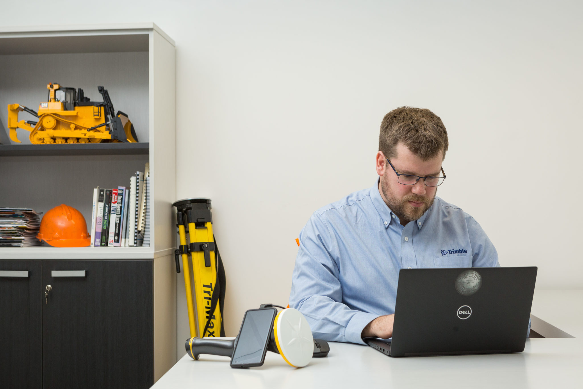
When the user connects a smartphone to the Trimble SiteVision Integrated Positioning System and turns it on, the SiteVision positioning systems starts up and automatically connects you to Trimble’s global GNSS correction service which enables high accuracy GNSS positions.
GNSS is the Global Navigation Satellite System and is most commonly known as GPS, but it also uses the satellites from other systems such as European, Russian, Japanese, or Chinese systems.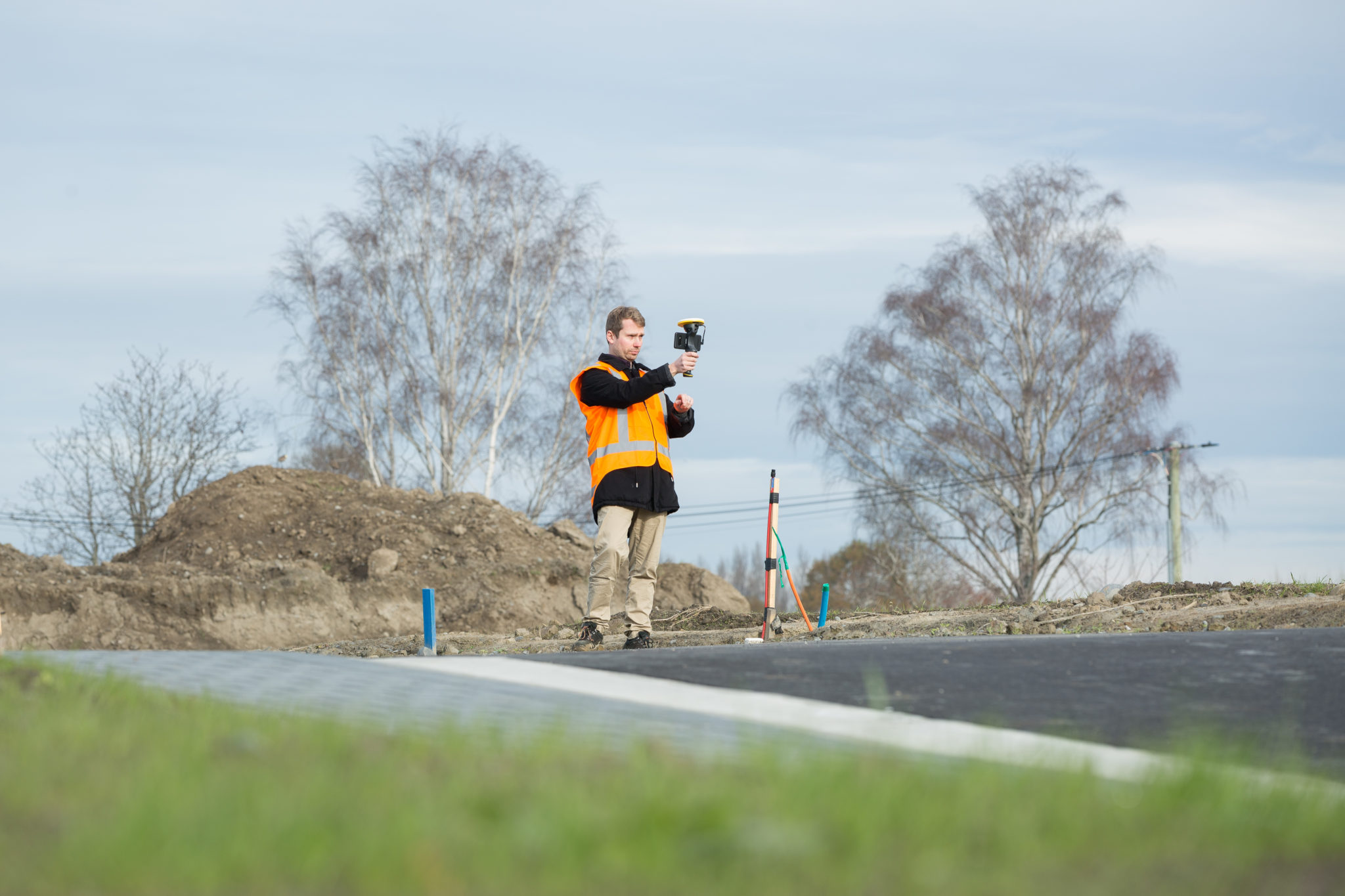
The SiteVision App tells the Trimble correction service where you are in the world, and then the service automatically connects you to the best available Trimble correction service at your location.
Within a couple of minutes the application knows where you are in the world to a few centimeters, or a few decimeters, depending on where you are and what correction services are available at your location.
If you want your model positioned in terms of your own correction service you can also configure the system to use your own reference station instead of the Trimble service.
Remember though, to get high accuracy, GNSS needs to see the sky, so it won’t work indoors, or well under trees or in an urban canyon. You will have to use un-aided AR positioning for those environments which will not be as accurate. While we love the accuracy of GNSS, SiteVision will also allow you to work with un-aided AR positioning for places where GNSS does not work. 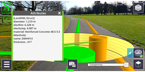
Orientation
OK, we have our model loaded and a high accuracy position, so why do we need to walk? The smartphone you use with SiteVision has to be one that works with the Google Play services for AR, and using Android operating system Version 9 (Check here to see if your device is compatible). Notice what Google calls the service, a Play service for AR. The AR services in phones were developed for all sorts of playful consumer purposes, but we want to use it for professional projects – and have fun doing it.
When the Google AR service starts up, it does not know where in the world it is, so we have to help it. The Google AR service does some really clever stuff using what is called visual odometry. What they do is look at all the little pixels in the video camera feed and work out where and by how much you have moved using camera image tracking, and also using the accelerometers in the phone.
The problem is though, that any small errors in the camera tracking accumulate over time, as do the errors in the accelerometer measurements.
So we have a device (your smartphone) that loses positioning accuracy over time and does not know where in the world it is.
This is where the SiteVision application delivers the goods. With the high accuracy GNSS it locates your model in the AR system at the right location in the real world to within a few centimeters or an inch or two.
Then we need to orientate the model, so we get to take a short walk. This walk creates a vector that we know the direction of to within about 1/10th of a degree, roughly 30cm or a foot of error at the far end of a football field – definitely good enough to visualize your model where you are and as far as you can see. And in case you are worried about how things will look if you walk to the other end of the football field, well relax. We constantly update the position and orientation of the model using GNSS as you walk so when you get to the other end of the football field it will still be correct within a few centimeters/inches.
Powerful Hardware
All this takes a great amount of computational power, so it could drain your phone battery very quickly, but we can help with that. We designed the SiteVision system with a lightweight battery in the unit, that provides power to the GNSS receiver, the EDM (an electronic distance measuring unit) and also tops up your phone battery to let you still make calls after using SiteVision for a few hours. And if you want to work longer, then you can swap out the battery whenever needed. We provide a couple of batteries with the system, so you don’t get caught short!
Visualize and Report
You can visualize your model in the field, which is pretty cool, but now you want to share images, or maybe get serious and create a few tasks for people on the project. With SiteVision you can take photographs with the augmented reality view, or adjust the transparency to take photographs of the actual scene on site, and send them back to Trimble Connect as a “ToDo”, with assigned dates, task owners etc. Trimble Connect shares these photos with the people you select to share them with, complete with the task instructions. 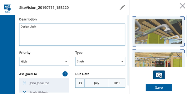
Measure
Not only does SiteVision allow you to visualize your 3D model in the field, but it also allows you to make measurements. You can measure between points in the real world, points in your model, or between the model and the real world. For real world measurements you can use the GNSS in the system to take measurements, and because we care about safety we added the ability to measure to remote points, such as points on a roadway, or the depth of a trench using a combination of the GNSS, the EDM, and the heading from the AR system. These remote points are not as accurate as measuring with GNSS because they rely on the sensors in your phone and the visual odometry, but they are still very useful, and really quick to take. All the measurements can be sync’d with the office using the Trimble Connect service.
To keep things simple we have wrapped all the services up in one subscription bundle – the GNSS correction positioning services, the cloud services for optimizing data, storing your models, sharing your images and more!
More Trimble SiteVision
Subscribe to the Trimble SiteVision blog so you'll be alerted with the latest posts.