

The Future for Cadastral Surveyors: Augmented Reality
Read more on the main uses of SiteVision for cadastral surveyors and how the system enriches your data.
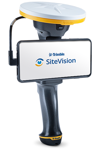
SiteVision is a great tool for visualizing data but what value does it provide to me as a Cadastral Surveyor?
Great question.
SiteVision has three main uses for Cadastral Surveyors:
-
Finding survey monuments for the origin of your survey (Point of Beginning)
-
Communicating property line information, including natural boundaries, to your clients
-
Checking occupation against property lines to check for encroachment
Let’s look at this in more detail.
Finding survey monuments for the origin of your survey (Point of Beginning)
Firstly, SiteVision is a great tool for getting your survey started. When you first arrive on the job, particularly for rural jobs, SiteVision is a great tool for searching for your survey origin or Point of Beginning and other old survey marks and boundary markings.
Before leaving the office download any data you have from sources like digital cadastral databases, to old plan data that you have entered into Trimble Business Centre, and drop it into a Trimble Connect project.
SiteVision, being a lightweight handheld system that works with Trimble’s global correction services including VRSNow and RTX, is quick and easy to use for finding those original survey marks in your reconnaissance phase. Once located, get your R8 or R10 out of the truck and undertake the survey with Trimble’s high performance GNSS, or an S series Robotic Total Station for maximum accuracy.
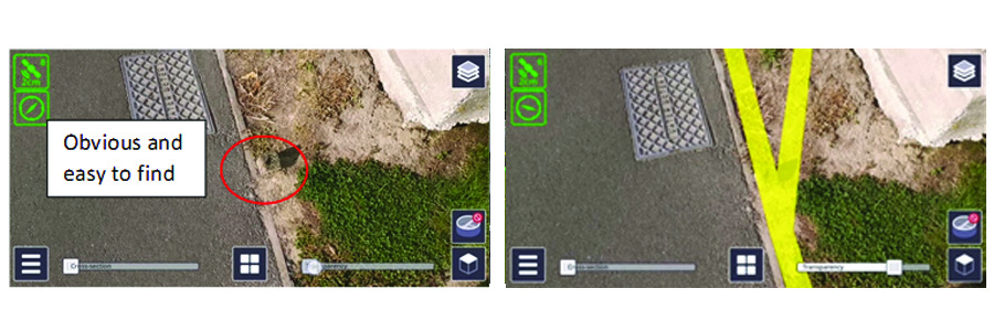
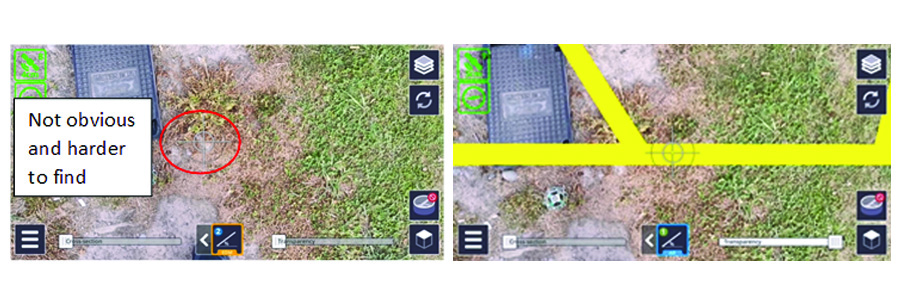
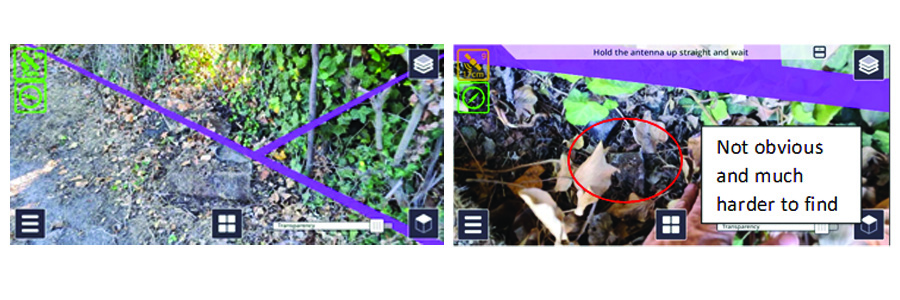
Not only does SiteVision provide a quick and easy visual way to locate survey marks, the data is also fully attributed.
In the example above, showing the boundary between the legal road and the recreation reserve, the process to prepare the data was as simple as:
- Going to the national digital cadastral database
- Downloading a file in the ESRI SHP file format in the local datum
- Drag and dropping the file into Trimble Connect
- Starting SiteVision on site
- Setting the GNSS target reference frame to match the local datum
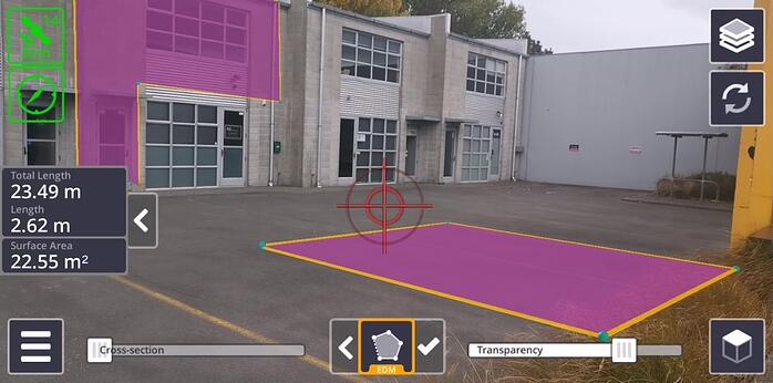
- Selecting the model and viewing. The 2D boundary data is overlaid on the ground at the elevation of the user.
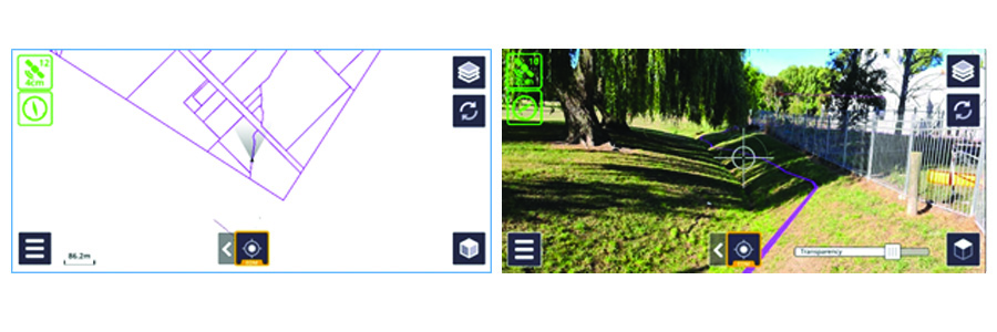
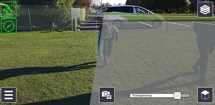
SiteVision also makes it easy to understand natural boundaries and how they may have changed between the time of survey in the past and the current location. In the images below a watercourse that was a natural boundary has been re-routed and is no longer on the boundary.
Augmented reality images provide context and evidence in the determination of natural boundaries.
Communicating property line information, including natural boundaries, to your clients
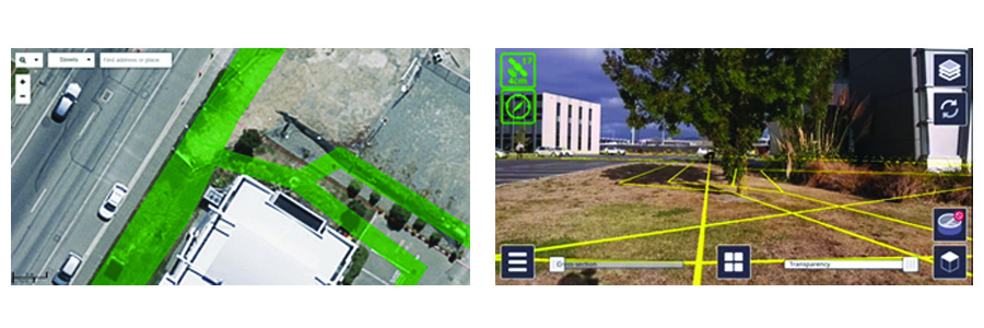
The second application is communicating to land owners or potential property purchasers where boundaries lie. Showing an owner a plan, even with an aerial map background is one thing, but walking, visualising and even marking the approximate location of the boundary on site is another.
With SiteVision you can capture images and send via the ToDo application to your clients, or capture a video of walking the boundaries and share with clients. The images below show a few examples comparing showing boundaries overlaid on imagery (the latest publicly available) with what you see on the ground with SiteVision and AR presented boundaries. In the first and last image pairs you can see that the site has changed significantly since the aerial photography was taken.
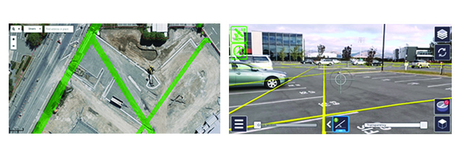
In addition to illustrating property lines on the ground, augmented reality images can also convey improved understanding of property lines for strata titles.
Clearly for the general public, particularly those not versed with reading maps, the augmented reality view from SiteVision is much easier to understand. This is illustrated below where the approximate location of a proposed boundary change is marked out by a member of the public, guided with the AR model in SiteVision.
Checking occupation against property lines to check for encroachment
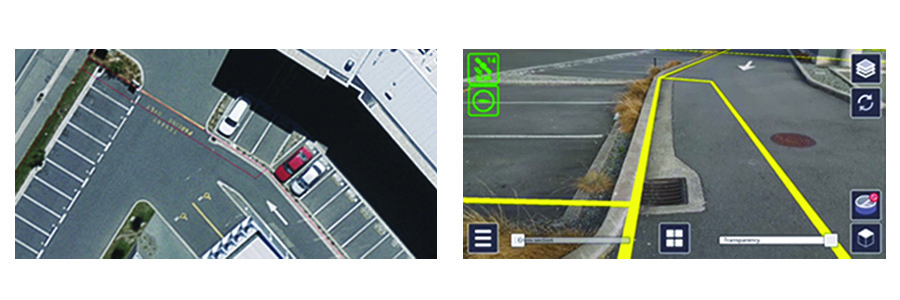
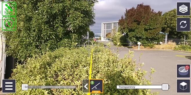
The third application is as a quick and easy way to check occupation against boundaries for possible encroachment, or occupation that projects into the recession planes required under local regulations.
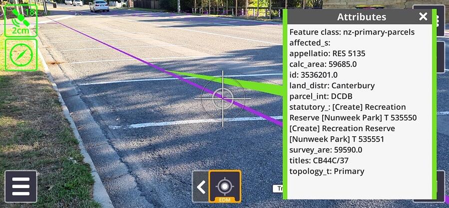
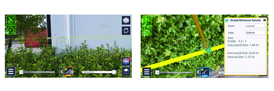
 Here we check with a quick EDM measurement to the occupation (building) and select a point on the boundary line in the AR model to confirm the horizontal offset. In this case the building is approximately 0.43 meters inside the boundary.
SiteVision is a quick and easy to use, versatile augmented reality solution for Surveyors. It is important to understand that orientation is dependent on the combination of the GNSS and the smartphone AR system, and given limitations in the AR technology, SiteVision EDM measurements are not warranted for legal survey work.
If the SiteVision system indicates that there is a potential issue, then undertake an accurate, detailed survey with your Trimble survey equipment.
Want to learn more about SiteVision for Surveyors, click here >
More Trimble SiteVision
Subscribe to the Trimble SiteVision blog so you'll be alerted with the latest posts.