

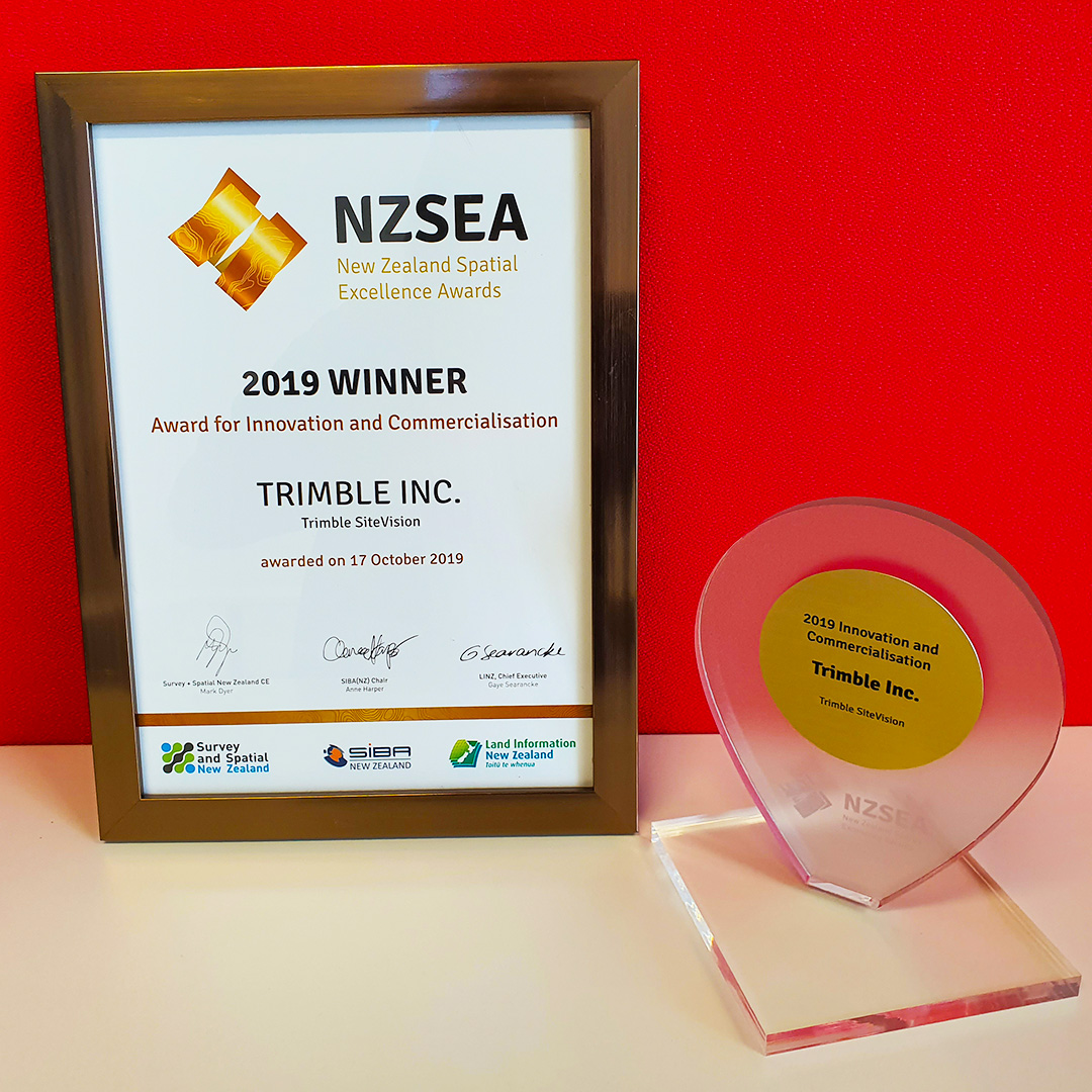
Trimble SiteVision Wins the New Zealand Spatial Excellence Award in Innovation and Commercialization
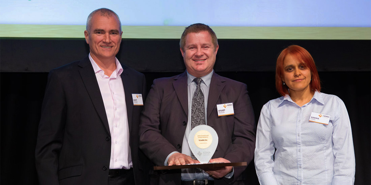
On October 17th, 2019, Trimble SiteVision was named as the winner of the New Zealand Spatial Excellence Awards (NZSEA) in the Innovation and Commercialization category, sponsored by NationalMap.
SiteVision is honored to be the recipient of this award and to be nominated alongside other groundbreaking products and initiatives bringing innovative solutions to complex business challenges.
About the New Zealand Spatial Excellence Awards
The New Zealand Spatial Excellence Awards are a joint initiative by Land Information New Zealand (LINZ), Survey and Spatial New Zealand (S+S NZ), and Spatial Industries Business Association (SIBA). Each partner contributes its resources and expertise to make sure the awards reach the highest standards of excellence and independence.
The awards seek out and give recognition to the best, the high achievers, and the contributors who set the benchmarks that others will follow, becoming the role models for the next generation of the spatial profession.
NZSEA provides a stepping stone for organizations and individuals to be nominated in the Asia-Pacific Spatial Excellence Awards (APSEA) – the only awards for the Asia Pacific region that recognizes the excellent achievements of both individuals and organizations engaged in the spatial information industry.
Source: NZSEA
Innovation and Commercialization Category
The Award for Innovation and Commercialization recognizes products or projects that made a significant contribution to the industry through the introduction of a new idea, method, technology, process or application resulting in social, environmental and/or economic benefits.
Specific criteria:
- Design of original solutions or ingenious adaptation of existing solutions.
- Innovative application of emerging or developing technologies.
- Commercial viability including market take-up of the innovation.
- Overcoming barriers of entry to market.
- Sustainability (social, cultural, environmental and/or economic) benefit to the industry or the community.
The judges of the NZSEA summarized Trimble SiteVision as:
Trimble SiteVision enables you to “see what you cannot see” and to view and understand complex spatial information accurately in the real world – underground power cables, pipes, and in-situ designs that will exist in the future. The augmented reality system visualizes things that would be difficult to identify in plan and cross section drawings with centimeter scale accuracy in 3 dimensions. This product will contribute significantly to urban planning and improved safety across many industries.
A Brief Story of SiteVision
In 1997 and 1999 two New Zealand innovators at Trimble filed patents. One on a centimeter accuracy handheld surveying system and the other on augmented vision for survey and machine control. Fast forward 20 years and that vision and innovation has now become reality as the SiteVision Augmented Reality system.
“We all live in the real world and are trained from birth to understand information by seeing it in context. Trimble SiteVision extends this capability that we all have by enabling you to see what you cannot see – things that are hidden, for example, underground objects and things as they will exist in the future.”
SiteVision makes it easy for people to understand complex spatial information by allowing users to see it in the real world – accurately. Using an Android mobile device connected to high accuracy GNSS you can walk through the real world seeing in-situ designs from buildings to roads to landscapes, and existing hidden services such as water supplies, power cables and pipes.
SiteVision transforms complex information into reality. It makes it simple for people to understand information by providing a real world context to the information. But seeing is not enough. Users of spatial data also need to measure, record and action tasks associated with that work and the integration of those two inventions into a single product is SiteVision.
Safety, Sustainability, Productivity
Making spatial simple
First and foremost the AR system eliminates the need for plan reading skills, presenting all types of spatial data in a simple spatially correct, 3D view. Things that are hard to identify using plan and cross section drawings, such as whether two services clash, can be immediately identified in the AR view simply by walking through the model.
Accuracy
To be of value for applications such as understanding the location of underground services, accuracy is paramount. SiteVision provides a real world AR view with an accuracy of a few centimeters in all three dimensions. Unlike other AR systems, SiteVision also provides the ability to record new position information and attributes.
Automation to achieve simplicity
SiteVision automatically geolocates any model that has georeferencing information. For models without a georeference a simple guided procedure uses either two measurements to tie the model to the real world, or a simple manual placement where accurate georeferencing is not possible using GNSS, for example indoors. High precision GNSS is achieved anywhere in the world by automatically selecting available VRSNow networks or using Trimble’s global RTX correction service. This all occurs with virtually no technical knowledge required by the user.
Data delivery
Using Trimble Cloud services field users can simply load available models, anywhere their smart phone has a data connection.
The Impact of Augmented Reality Technology
When SiteVision was submitted for the Innovation and Commercialization Award, a criteria was to describe how the project has on the community in terms of achieving social, cultural, environmental, economic, and technical benefits.
Example 1: Urban planning
In this process there is a need for public engagement and a need to explain to individual property owners how a proposed change will affect them. With SiteVision proposed designs can be loaded and members of the public can stand or walk around their property and observe how the changes may impact them.
Example 2: Improved safety and reduced utility strikes
Striking underground utilities is a common occurrence worldwide, costing hundreds of millions of dollars a year in damages, repairs and disruption to consumers. The current process involves combining GIS records or varying levels of accuracy with Ground Penetrating Radar surveys and pot holing to locate services before excavation. Markings are painted on the road that are lost with the first shovel load of excavation. With SiteVision workers, many of who are unskilled in reading plans, can simply view where the services are with SiteVision, and additionally safely measure trench depths, and accurately record the location of assets they find or place.
Example 3: Rapid understanding and processing of design changes to reduce construction costs
The system will be used to visualize designs, identify clashes, measure the size of clashes or additional points needed and instantly share that context awareness with the design team for revision.
Example 4: Residential development
The system can be used to enable future home owners to visualize their planned home from the street and then “walk” through their planned home design in the context of the subdivision and the surrounding views to clearly understand what their future home will be like.
Example 5: Landscape design
The system will be used to visualize a proposed landscape plan, at different stages of its life cycle, for example when the trees planted are 5, 10 and 20 years old, and across the different seasons
Learn more about the NZSEA, finalists and winners here: https://www.nzsea.org/2019.html
More Trimble SiteVision
Subscribe to the Trimble SiteVision blog so you'll be alerted with the latest posts.