

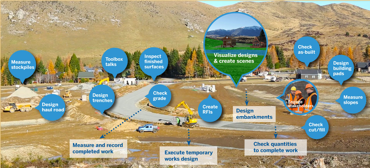
Beyond Visualization: Augmented Reality for Project Agility
The Trimble SiteVision team is pleased to announce that version 2.00 of Trimble SiteVision Software is now available!
Trimble SiteVision v2.00 was released on Google Play Store on June 16th. In this release, we go beyond visualization including improved features for better workflows and new tools for new workflows that allow the user to measure accurately and create data in the field.
Click here to view plans and pricing, and to find your Authorized Trimble Distributor.
In summary, the new features are:
- Create a model in the field
- Add a Sketchup model to a measured point
- Measure lines and areas
- Create Profiles
- Create Planes
- Edit attributes of captured data
- Layer Management
New Features
New Workflow – Create a model in the field
Now, you don’t need to upload pre-existing data in order to use the Trimble SiteVision apps. There is a new feature added, which allows the user to create a new blank model in the field and start using the apps. This allows the user to collect survey data, create conceptual designs, and design temporary works without preparing a model in advance. The new model functionality is found in the submenu of the “Load Model” option
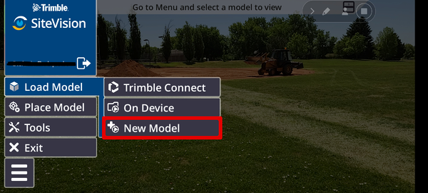
When creating a new model on the phone, a new folder is created on Trimble Connect in the SiteVision data project to store the data that will be created in the field. To continue, as the new model is created, an arbitrary coordinate system based on a Transverse Mercator projection with an origin of latitude and longitude at the user’s location will also be created.
See here for a tutorial on the different options for loading a model.
Add a Sketchup model to a measured point
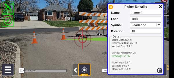 Example of assigning a 3D model of a Road Cone to a measured location
The app of “Measure Point” is now enhanced to allow the user to place any symbol of their choice to the measured location, allowing the user to create new scenes or models of the current scene. The symbols that can be used are Sketchup models either created by the user or downloaded from the millions of models that are stored on the 3D Warehouse. The user can rotate the symbol to match the desired scene. This enhancement allows the user to visualize design concepts on the fly which can be very handy for architects and landscape architects. It can also help surveyors and GIS specialists with QA/QC who can assign models to data that have been picked up providing a visual check on the data captured.
See here for a tutorial on this feature.
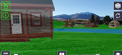 Example of a concept of a mountain village created using the earthworks design and SketchUp models placed and orientated using the Measure Point app.
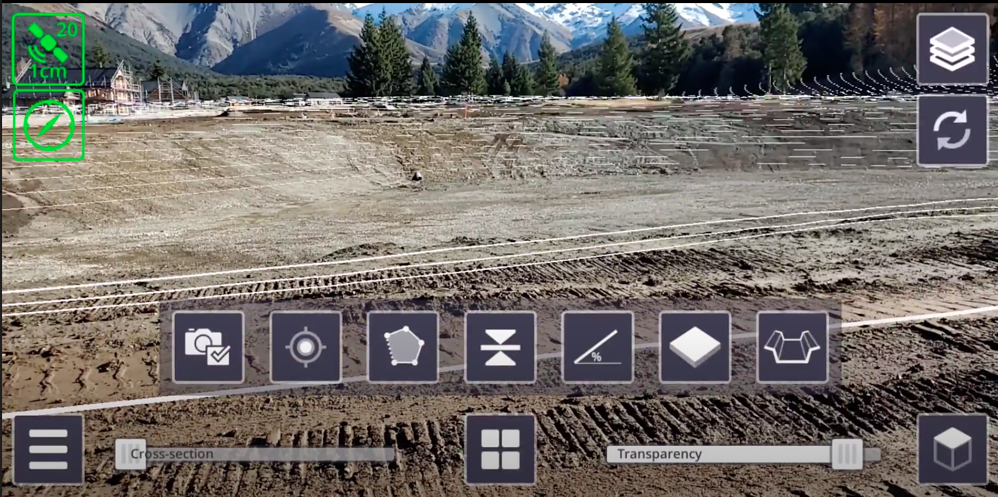
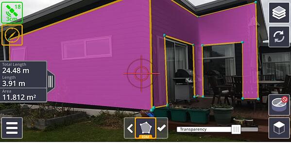
Measure lines and areas
A brand new app that is included in version 2.00 is one that allows the user to measure lines and areas. Now, the user can measure lines consisting of multiple segments, while also measuring the area that is created between them. Lines and areas can be measured using all the measurement modes, GNSS, EDM, and AR. The EDM option makes it easy to measure not only horizontal lines and surface areas can be measured, but vertical ones as well. This feature can be particularly useful for inspection purposes, providing visual feedback on what has been measured, reducing errors in collected data.
See here for a tutorial on how to measure lines and areas.
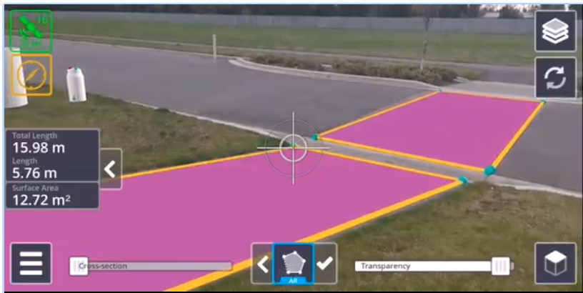 Measuring lines and areas horizontally.
 Measuring lines and areas vertically.
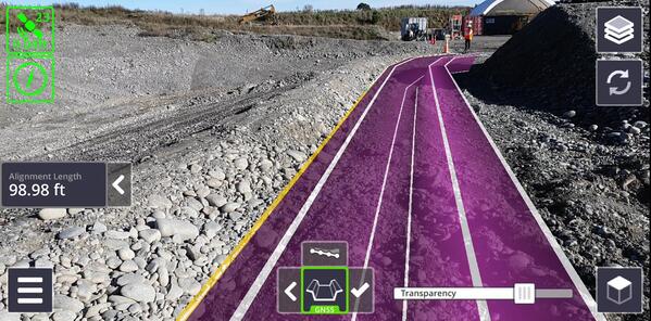
Create Profiles and Alignments
“Create Profile” is one of the two in-field design apps included in this version. With this app the user is able to create a profile of a trench or a bank (meaning that the profile that is being created can be either below or above the ground) and then select the points to define the direction of where the design is going to be excavated (in the case of a trench) or placed (in the case of a pile of materials). The in-field designs are created ready for use by Trimble Earthworks, allowing designs to be completed in the field and put onto earthmoving equipment for grading using Trimble Earthworks for immediate use, reducing downtime on machines.
See here for a tutorial on how to use this app and here for how to transfer your designs from your mobile device.
 Creating the template of a profile
 Designing a trench
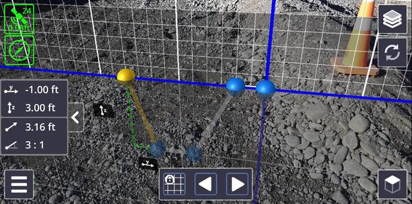
Create Planes
“Create Planes” is the second of the in-field design apps which allows the user to design a plane. Initially, the plane is square with dimensions of approximately 30 feet by 30 feet. The user can then dynamically adjust the dimensions to suit by dragging the blue handles shown in the image above. The plane can be offset vertically. For example, to cut a building pad you can enter the depth required to strip the topsoil and any other material that needs to be removed, to excavate a flat base, minimizing the quantity of backfill material while achieving the required foundation thickness. For other applications, such as grading an area to ensure good drainage, the app provides the option of creating sloped ones as well. Similar to the profile design, the file corresponding to the design can be easily transferred to the Trimble Earthworks platform for automated machine control.
See here for a tutorial on how to create planes.
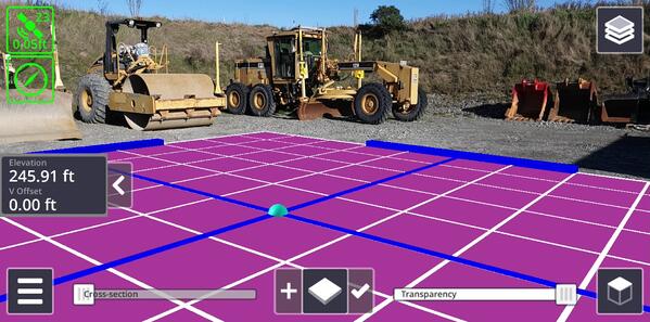 Designing a building pad
Edit Captured Data
Now, the user doesn’t have to worry about mistaken measured points or sequencing of measurements, because with version 2.00 points measured in the field can have their attributes (name, code, symbol, and symbol orientation) edited and points can be deleted or inserted.
In the app of “Measure Point” this functionality translates to the following:
- The user can select a previously measured point and change the selected symbol, and symbol rotation to depict the point.
- The user can delete a point, either once it’s measured or at a later time.
In the apps of “Measure Lines and Areas” and “Creating a Profile” this functionality translates to the capability of adding points in between existing ones, but also deleting points after they have been measured.
Deleting data is also applicable to the apps of “Measure Cut/Fill” and “Measure Grade and Distance.”
Layer Management
This is new functionality and it applies to all of the Trimble SiteVision apps. Whenever a user is making measurements a layer is created to save this data. For example, when the app of measuring points is used, a layer is created and all data is stored in that layer. Each layer corresponds to each type of measurement. For example, if a user measures a few points but also creates some planes, then there will be two layers created, one for the points and another one for the planes. This helps with controlling which data to have visible at any given point.
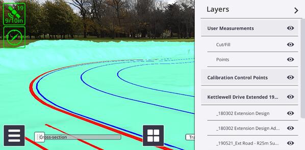 Layers are created as data is measured
In summary, version 2.00 of Trimble SiteVision includes new workflows and apps that span beyond just visualization. Now, one can make different measurements and designs in the field. Trimble SiteVision is a tool for “seeing” your data, but also for performing tasks on the job-site easily and fast.
 SiteVision is now applicable across the whole development life cycle, from concept to completion.
Resources:
Trimble SiteVision Support Portal
Trimble SiteVision v1.10 Release Notes
Trimble SiteVision User Guides
Trimble SiteVision YouTube Channel
Want to learn more about SiteVision, click here >
More Trimble SiteVision
Subscribe to the Trimble SiteVision blog so you'll be alerted with the latest posts.